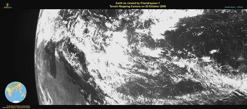
The Terrain Mapping camera (TMC) on board Chandrayaan-1 spacecraft was successfully operated on October 29, 2008 through a series of commands issued from the Spacecraft Control Centre of ISRO Telemetry, Tracking and Command Network (ISTRAC) at Bangalore. Analysis of the first imagery received by the Indian Deep Space Network (IDSN) at Byalalu and later processed by Indian Space Sci ence Data Centre (ISSDC) confirms excellent performance of the camera.The first imagery (image 1) taken at 8:00 am IST from a height of 9,000 km shows the Northern coast of Australia while the other (image 2) taken at 12:30 pm from a height of 70,000 km shows Australia�s Southern Coast.

TMC is one of the eleven scientific instruments (payloads) of Chandrayaan-1. The camera can take black and white pictures of an object by recording the visible light reflected from it. The instrument has a resolution of about 5 metres.
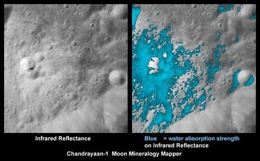
Besides TMC, the other four Indian payloads of Chandrayaan-1 are the Hyper spectral Imager (HySI), Lunar Laser Ranging Instrument (LLRI), High Energy X-ray Spectrometer (HEX) and the Moon Impact Probe (MIP). The other six payloads of Chandrayaan-1 are from abroad.
It may be recalled that the 1380 kg Chandrayaan-1 was successfully launched into an initial elliptical orbit around the Earth by PSLV-C11 on October 22, 2008. This was followed by four orbit raising manoeuvres, which together raised Chandrayaan-1's orbit to a much higher altitude. The spacecraft is now circling the Earth in an orbit whose apogee (farthest point to Earth) lies at 267,000 km (Two lakh sixty seven thousand km) and perigee (nearest point to Earth) at 465 km. In this orbit, Chandrayaan-1 takes about six days to go round the Earth once. The spacecraft performance is being continuously monitored and is normal
References : https://www.isro.gov.in/